What Is Central Phoenix? Understanding Its Neighborhoods and Distinct Areas
Ask five people to draw a line around “Central Phoenix” and you'll get five different maps. Some will include Arcadia. Others will insist Arcadia is its own thing, closer to Scottsdale in feel than to downtown.
A few will stop at 7th Street and 7th Avenue and call everything past that something else.
None of them are wrong exactly. That's the first thing to understand about this part of the city: Central Phoenix isn't a neighborhood with a fence around it. It's a label people use for a cluster of older, closer-in neighborhoods that grew up independently of each other over most of a century, and where the line falls depends on who's talking.
What Does Central Phoenix Include?
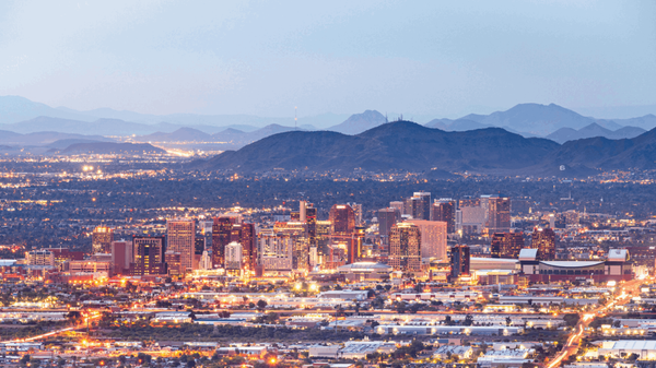
The City of Phoenix organizes its planning around 15 urban villages, and the closest thing to an official version of “Central Phoenix” is Central City Village, which covers downtown and the surrounding blocks out to roughly 19th Avenue, the Grand Canal, and the Salt River. Encanto Village sits just northwest and holds Midtown, Uptown, and the Melrose District. Camelback East Village picks up east of Central Avenue and reaches out toward Arcadia and the Biltmore.
Almost nobody uses those planning boundaries day to day, though. Agents, longtime residents, and MLS neighborhood maps tend to describe “Central Phoenix” more loosely — generally the older core of the city built out before 1960, running along the Central Avenue spine from downtown up toward Northern Avenue, with pockets branching east toward Camelback Mountain and west toward the historic districts near 7th Avenue.
Some people fold Arcadia into that definition. Others treat it as its own East Phoenix category, or separate North Central Phoenix out entirely because the lot sizes and housing stock feel so different from the historic districts closer to downtown.
There's no governing body settling the argument.
The practical takeaway: when a listing, an agent, or a friend says “Central Phoenix,” it's worth asking what they mean specifically. It could describe a walkable 1920s bungalow two blocks from light rail, or a quarter-acre ranch house a mile from the nearest sidewalk.
Why Central Phoenix Is So Diverse
The variation isn't random. It comes from how this part of the city actually got built.
Most of Central Phoenix wasn't developed as one project. It grew out of dozens of separate subdivisions, platted independently by different developers between the 1910s and the 1960s, each with its own lot sizes, deed restrictions, and architectural leanings. Willo alone was assembled from 22 separate subdivisions before it blended into what people now think of as a single neighborhood.
That piecemeal history is why crossing one street can drop you into a different housing era entirely. Bungalows and Spanish Colonials from the 1920s sit blocks from postwar brick ranches. Some pockets carry flood-irrigation rights left over from citrus-farming days; others never had that kind of tree canopy to begin with.
Historic preservation adds another layer. Willo, Coronado, and Encanto-Palmcroft are officially designated historic districts with design review and renovation guidelines. Neighborhoods with similar-era housing that never went through that process give owners more latitude to remodel, add on, or tear down and rebuild — which is exactly what's happening across parts of Arcadia and North Central right now.
Lot size is its own variable. Downtown and Midtown lean toward condos, lofts, and compact infill built for density. North Central and Arcadia run the opposite direction, with quarter-acre and half-acre parcels that were never built with walkability in mind.
And then there's simple wear. Some blocks have had decades of careful upkeep and high-end remodels; others still have original systems and original owners.
Two homes on the same block, same era, same square footage, can be in entirely different condition — part of why “Central Phoenix” resists generalization.
A Brief Look at Central Phoenix's Major Areas
This isn't every neighborhood associated with Central Phoenix — that list would run for pages. These are the areas people ask about most, with boundaries drawn as commonly as they can be verified. Sources disagree at the edges, so treat these as general orientation rather than surveyed lines.
Willo, Coronado, and Encanto-Palmcroft
These three sit closest to downtown and hold some of the city's best-preserved early architecture. Willo, roughly bounded by 7th Avenue, McDowell Road, and the alley north of Edgemont Avenue, is one of the largest historic districts in the city, built across 22 subdivisions between 1910 and 1950 in styles running from bungalow to Tudor to Ranch.
Coronado sits just east, between 7th and 14th streets, with a similar mix of early-1900s bungalows and an active neighborhood association. Encanto-Palmcroft, centered on Encanto Park and its golf course, is widely regarded as one of the city's most prestigious historic addresses, with roughly 330 homes dating back to 1927.
Roosevelt Row and the Melrose District
Roosevelt Row is downtown's arts district — galleries, street art, and the neighborhood where Phoenix's First Friday art walk started in the 1990s. Housing here leans toward lofts, apartments, and newer infill rather than single-family homes on quiet streets. The Melrose District, a mile-long stretch of 7th Avenue between Indian School and Camelback, carries a strong midcentury architectural identity and is known as the center of Phoenix's LGBTQ+ community.
Downtown, Midtown, and Uptown Phoenix
Downtown is the city's government, sports, and cultural core — Chase Field, Footprint Center, the Arizona Science Center — connected to light rail and Sky Harbor. Midtown, stretching north along Central Avenue, is lined with office towers and cultural anchors like the Phoenix Art Museum and the Heard Museum, alongside a growing stock of apartments and condos. Uptown Phoenix picks up farther north around Camelback and Bethany Home, where the feel shifts from high-rise to a mix of shopping centers, restaurants, and established residential streets just off Central.
North Central Phoenix
North Central runs along Central Avenue roughly from Bethany Home Road to Northern Avenue, between 7th Avenue and 7th Street, though some locals push the boundary north toward Dunlap. The area began in the 1890s as the Orangewood citrus subdivision, and the Murphy Bridle Path — a walking and riding trail down the center of Central Avenue — is a direct holdover from that era. Brick ranch homes on quarter- and half-acre lots dominate, and the light rail runs the corridor's full length.
Biltmore and the Camelback Corridor
The Biltmore sits around 24th to 32nd streets along Camelback Road, anchored by the Arizona Biltmore resort and Biltmore Fashion Park. Housing ranges from gated single-family estates to mid-rise and high-rise condos, with a more urban, financial-district feel than the residential streets to the west. “Camelback Corridor” is the broader, informal term locals use for the stretch of Camelback Road connecting the Biltmore out toward Arcadia — it describes a vibe and a commercial strip, not an official boundary.
Arcadia
Arcadia sits at the foot of Camelback Mountain, generally between 44th Street and Scottsdale Road, with the Arizona Canal as its southern edge. It was citrus farmland until the 1950s, and the flood-irrigation system built for those groves is why the neighborhood still reads as unusually green for the desert. Locals typically call this core Arcadia Proper — the largest, oldest lots, closest to the mountain.
Arcadia Lite
Arcadia Lite is the area generally west of 44th Street, where lots run smaller and newer infill and rebuilds are more common. It shares Arcadia's general character — mature trees, proximity to the same restaurants and canal path — without the largest estate lots. Some locals draw a further line for “Lower Arcadia” south of Indian School Road; none of these sub-boundaries are official, and you'll see slightly different maps depending on the source.
One detail worth knowing regardless of which Arcadia pocket you're looking at: part of the area technically sits in Scottsdale rather than Phoenix, and much of it is served by Scottsdale Unified schools despite the Phoenix mailing address — a good reminder that these boundaries were never drawn with precision in mind.
Why the Specific Neighborhood Matters
None of this is trivia. If you're comparing properties across Central Phoenix, the neighborhood name on a listing tells you almost nothing on its own about lot size, home age, architectural style, walkability, or what a renovation will involve.
A “Central Phoenix” search can turn up a 1928 bungalow inside a historic-district overlay with design review requirements, a brick ranch on a third of an acre with no restrictions at all, or a downtown loft with an HOA and no yard. All three are accurately described as Central Phoenix. None of them are comparable properties.
That's exactly why the next step isn't pricing spreadsheets or market statistics — it's figuring out which of these pockets actually fits what you're looking for. Once that's clear, the conversation about what it costs to buy there, and what trade-offs come with it, actually means something. That's what the next piece in this series looks at.
About Brian Eastwood
Brian Eastwood is a Realtor based in Phoenix, Arizona, helping local buyers and sellers navigate the Valley’s shifting market with straightforward, data-driven guidance. If you’re trying to figure out which Central Phoenix neighborhood fits your lifestyle, budget, and long-term plans, reach out to talk through your options. 📲 Call or text me at 602-330-6813.
Categories
Recent Posts